Blog

5 Reasons to Combine CAD with a Quality RMS

Record management systems (RMS) and computer aided dispatch systems (CAD) have been going through some massive changes. Data is being collected, organized and ultimately used in a variety of new ways. Through RMS and CAD, police work is becoming easier and more efficient with access to broader and more complete data. 

However, two systems aren’t always better than one. In this article, we’ll give you a breakdown on why combining your CAD with a modern RMS system increases productivity, communication and makes your department and community safer. 

Benefits of Police CAD RMS Systems

There are many benefits to using a modern police CAD RMS system. Let’s look at the top five. 

Accelerated Response Times

One of the biggest benefits of adding a CAD – RMS system for your law enforcement, public safety and incident responders agency is the benefit of accelerating response times. The features of this system decrease the coordination time it takes to get responders on the scene and enhances the safety of both the responders and those involved in the incident. Many benefits of combined police CAD and RMS systems focus on resource efficiencies and improved processes.

CAD RMS Interface in CivicRMS

By integrating CAD RMS software, law enforcement agencies can streamline efforts by accessing real-time data to and from valuable partners at other departments, emergency responders, criminal justice systems and much more. CAD RMS software can also extend to state transportation departments that provide essential on-scene support, enabling them to respond more quickly.

With CivicEye’s RMS and Fusion Center system, you are able to integrate your computer aided dispatch with several benefits to provide real-time time information to local, state and federal agencies. Responders can work with extreme efficiency and productivity. 

With the faster response times, CAD RMS systems can help keep the public safe by getting traffic control on the scene of accidents or hazardous spills and facilitating faster notifications to travelers and specialized incident response crews.   

Improved Responder Safety

New police CAD RMS systems can use GPS systems to help their agencies locate personnel and track equipment. Officers and responding personnel can be outfitted with mobile technology that allow them to access information in the field. Records can be searched with required fields and filters, reducing errors and the amount of time spent generating reports. Without the need to return to an office, more officers remain in the field protecting the public. Through CAD RMS software, mutual aid partners can operate seamlessly to share information and data across agency lines for quicker response times and more efficiency. 

CivicEye software enables your agency to obtain information that helps plan staffing, equipment needs, and organizational processes. With less time spent on administrative tasks, a CAD RMS system helps officers and first responders be available and in the best position to get to incidents and protect the public. 

Incident Mapping

One of the most important aspects of police CAD RMS systems is the ability to use interactive incident mapping. What can incident mapping do for your CAD RMS system? Your agency will be able to visualize incident location patterns with a map overlay of CAD RMS information. You can filter by incident to get a quick view of regions where certain crimes are more prevalent.

Police CAD RMS systems and the incident mapping features have come a long way in a few short years. Information can now be at your fingertips in a matter of seconds and can pinpoint where emergencies and crime are consistently happening. Through police CAD RMS systems, police are able to use the maps and geographic information to identify trends and patterns, which lends to a better plan for allocating resources. 

The CAD RMS software can also incorporate information from other sources to further tailor responses. This can include weather forecasts, traffic data, and other factors that can help responders make as informed a decision as possible. 

With CivicEye’s RMS software, you will have access to all these features that give your officers and responders an advantage. CivicRMS offers real-time dashboard capabilities for mapping and event tracking. Graphs and maps are available in real-time, making accident reports and handling easier for both dispatch and those who arrive at the scene.

Expanded Performance Measures

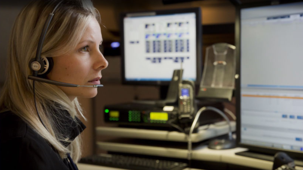
With police CAD RMS systems, you can expand your ability to track key performance indicators and gather data pertinent to department performance. While real-time data aids in the performance of critical operations, more complete historical data obtained through your CAD RMS system can provide the foundation for a large performance management strategy. When CAD and RMS systems don’t integrate, duplicate entries are both antiquated and counterproductive. You don’t have to worry about this with advanced integrations for CAD RMS systems with CivicEye.

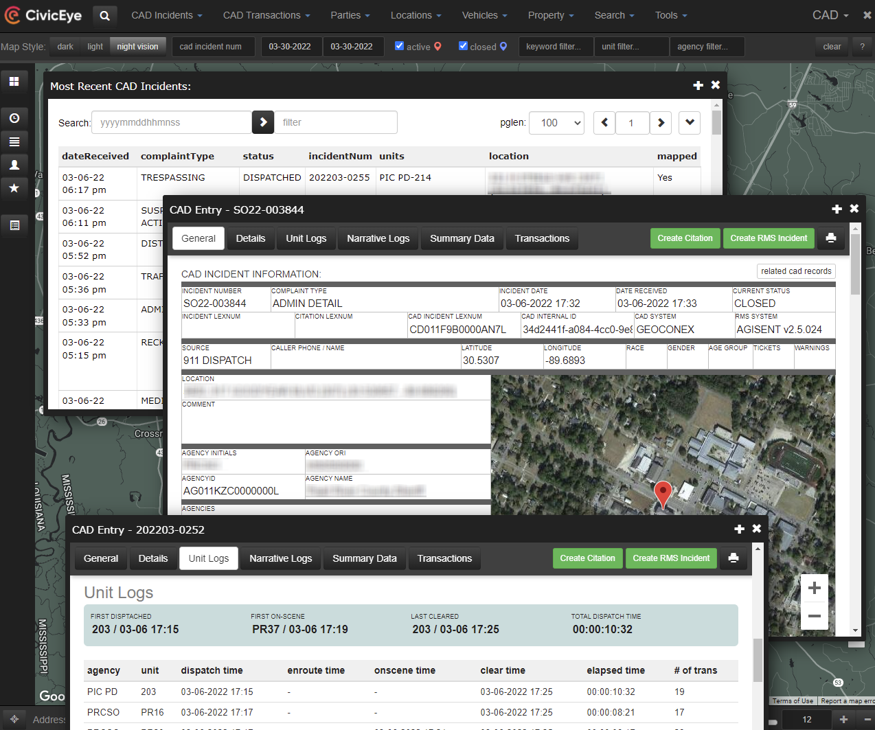
Law enforcement and public safety data from police CAD RMS systems can provide the most accurate, up-to-date data that is critical to incident response and duration tracking, incident types, severity, impact reports, and responder activities. But, when you are able to combine that data with information such as traffic volumes, queue length, devices used and activated, and department of transportation response team details, you get a more complete data set with which you can perform many different analyses.

When using police CAD RMS systems, all of this valuable data creates reporting and analysis capabilities that aren’t otherwise available. Debriefs, reports, resource utilization, and incident traffic impacts can all be analyzed and reported quickly and accurately without any manual intervention. 

With CivicEye’s complete module system, incidents, accidents, and crime data is recorded and stored in a cloud-based system. Previous incident information can quickly be recalled for use in other investigations or trend analysis, or to help you plan staffing coverage for particular days, times, or locations. 

Improved Traveler Information

Combining CAD RMS software affords your organization the ability to improve traveler information. The combined computer aided dispatch and response management system can help provide more accurate and complete information to motorists by integrating data from tools such as dynamic messaging signs, 5-1-1 systems, or mobile alerts. You can also help keep motorists safe by releasing detailed travel information that includes accident warnings, lane impacts or shifts, and other potential delays. 

These systems can be customized so you can release only the information that is most relevant to the public. Numerous data fields are available, but you can use only those that are most pertinent to your particular incident or situation and release that to the public via the 5-1-1 system. You can also push public advisory information through outlets like social media, websites and mobile apps. With a multi-channel approach, travelers get the quick and accurate information they need to keep safe. 

CivicEye works with your dispatch to gather accurate information, ensuring that nothing is released to the public prematurely or inaccurately. CivicEye RMS offers unmatched ease and effectiveness so you can work seamlessly with law enforcement agencies all over the country. With this technology, the public is safer and your agency can work more efficiently. 

Try CivicEye Today

When you are ready to combine your CAD RMS systems, CivicEye is the company for you. As one of the industry leaders in public safety software, CivicEye’s RMS system can help integrate your law enforcement team with dispatch, EMS, and fire personnel, making your community its safest possible version. Get in touch today for a free demo to see how your agency can reap the benefits of a top-notch CAD RMS system.

See what CivicEye can do for your organization

Name(Required)